| |  | | | |
|---|
 | | |  | | |
| | |  | | |
| | | 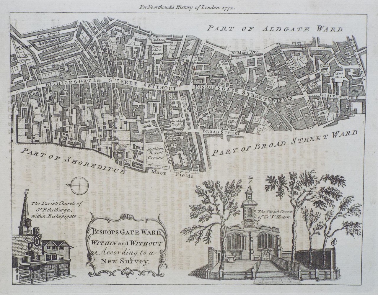 | Bishops Gate Ward Within and Without According to a New Survey.
Ref: P/30746
Region: London
Type: Copper
Engraver: Bowen T
Date: 1772
 |
| |
| | | 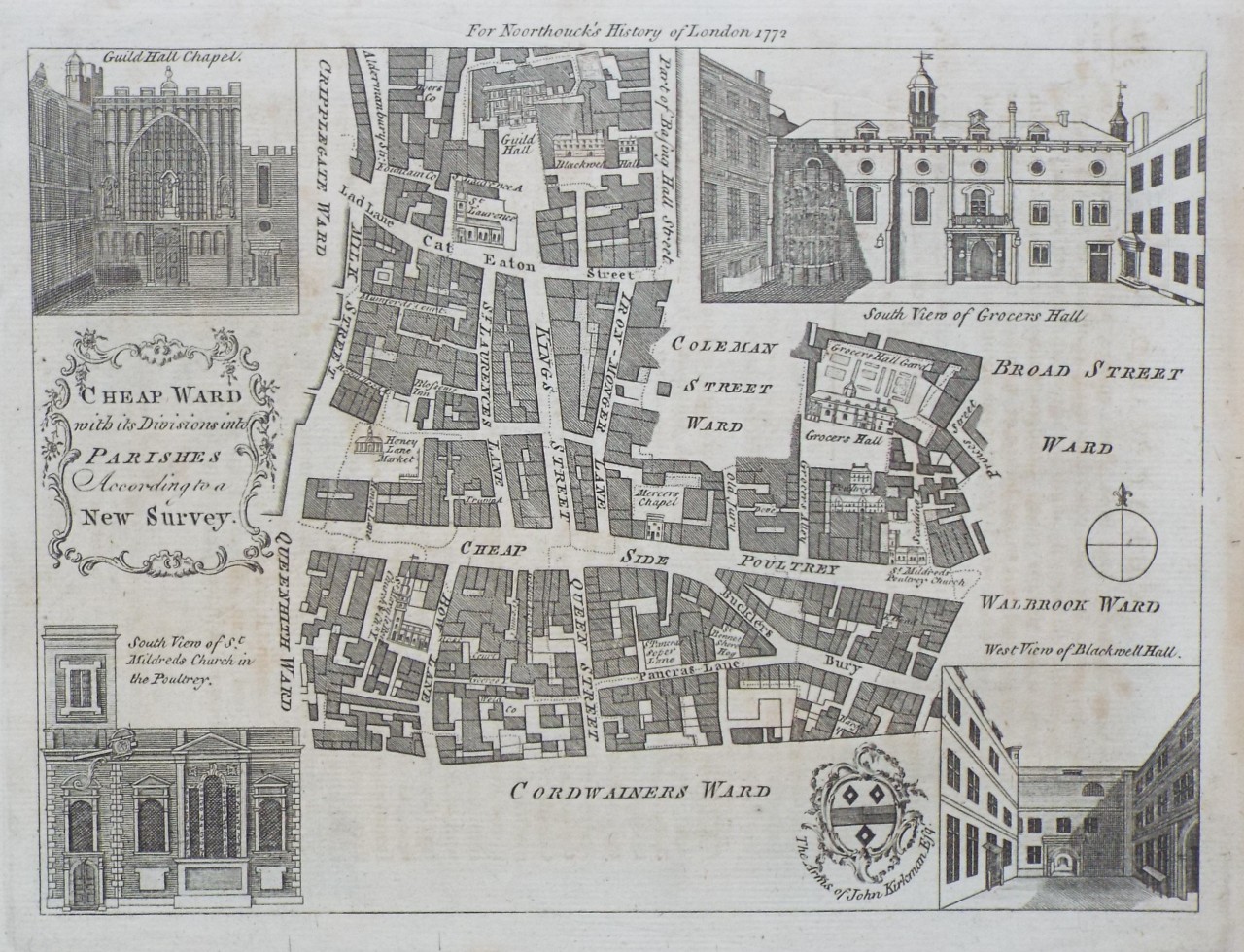 | Cheap Ward, with its Divisions into Parishes According to a New Survey.
Ref: P/30745
Region: London
Type: Copper
Engraver: Bowen T
Date: 1772
|
| |
| | | 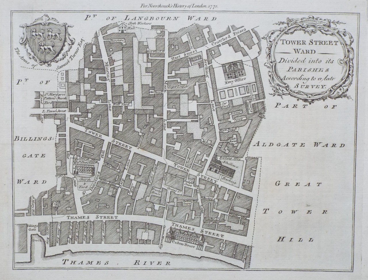 | Tower Street Ward Divided into Parishes According to a late Survey.
Ref: P/30752
Region: London
Type: Copper
Engraver: Bowen T
Date: 1772
|
| |
| | | 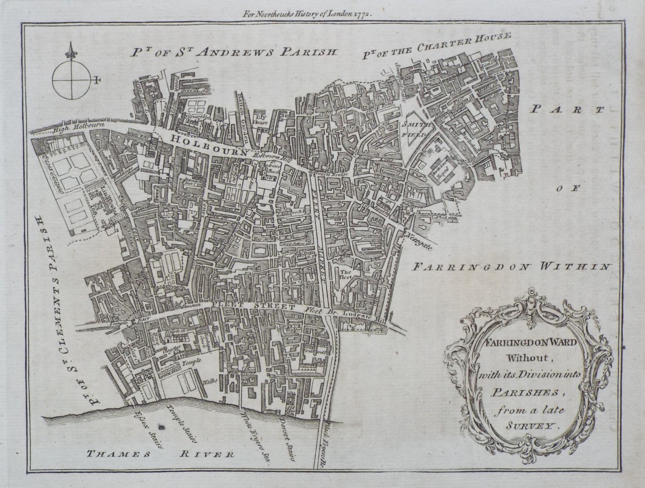 | Farringdon Ward Without, with its Division into Parishes, from a late Survey.
Ref: P/30748
Region: London
Type: Copper
Engraver: Bowen T
Date: 1772
|
| |
| | | 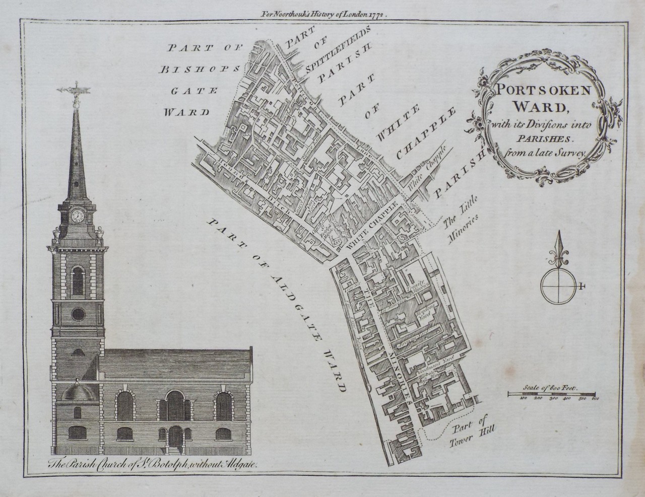 | Portsoken Ward, with its Divisions into Parishes, from a late Survey.
Ref: P/30749
Region: London
Type: Copper
Engraver: Bowen T
Date: 1772
|
| |
| | | 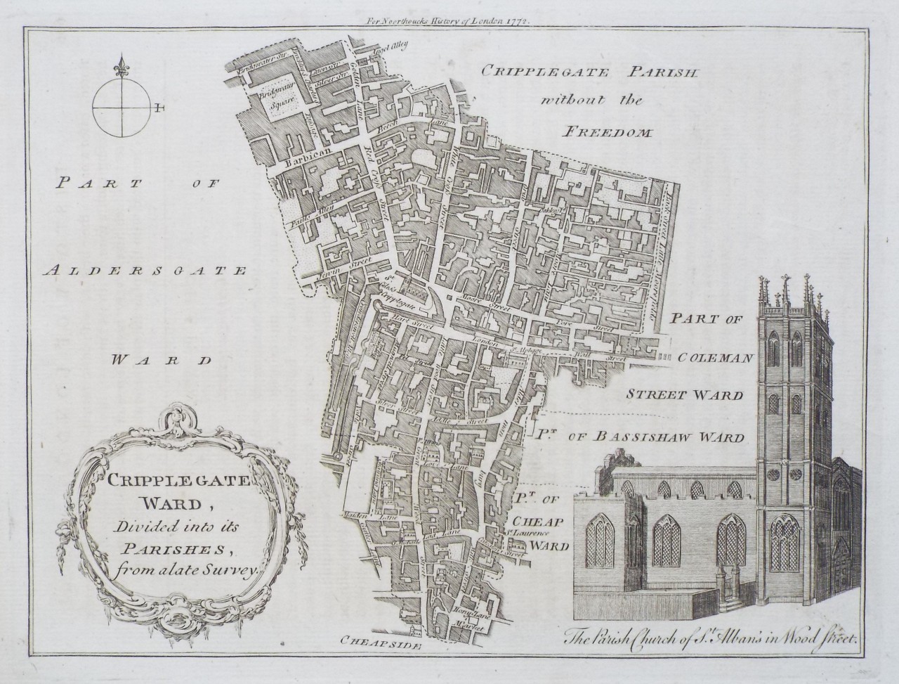 | Cripplegate Ward, Divided into its Parishes, from a late Survey.
Ref: P/30738
Region: London
Type: Copper
Engraver: Bowen T
Date: 1772
|
| |
| | | 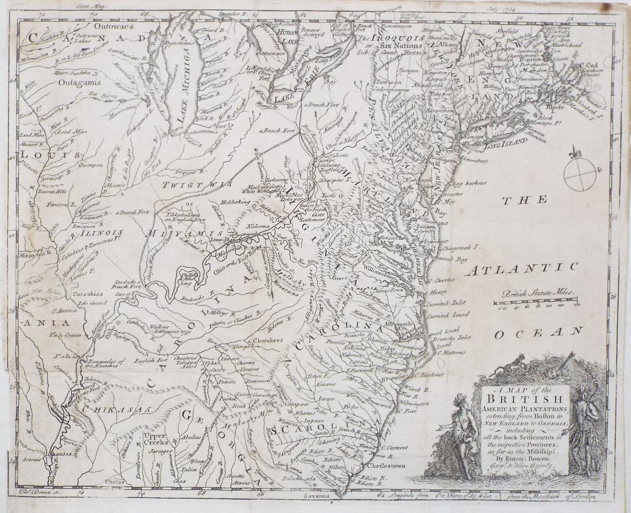 | A Map of the British American Plantations extending from Boston in New England to Georgia; including all the back Settlements in the respective Provinces, as far as the Mississipi.
Ref: P/30753
Region: East Coast
Type: Copper
Cartographer: Bowen E
Engraver: Bowen T
Date: 1754
|
| |
| | |  | | |